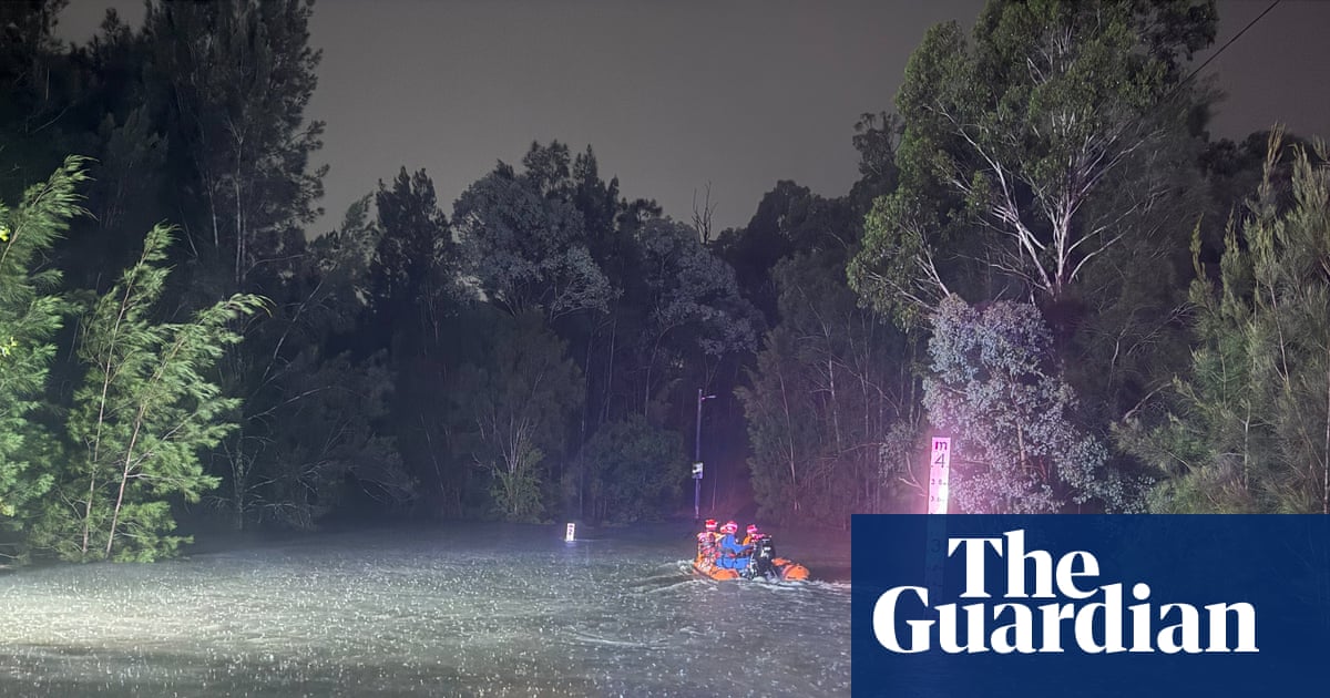
A heavy burst of more than 100mm of rainfall over three hours in Australia’s most populous city has led to flash flooding, evacuations and rescue operations as vast areas across the nation’s north and south stand by for continued drenching.
There were 42 rescues in Sydney overnight into Friday, with more than 250 personnel across the city responding to about 500 calls for help, particularly in the south-west, the New South Wales State Emergency Service said.
Sign up: AU Breaking News email
It was especially severe in Fairfield, about 30km from the city centre, where six people were rescued after becoming stranded by rising flood waters on Vine Street.
A few streets over, about a dozen properties were evacuated due to flood water inundating homes on Spring Street.
SES assistant commissioner Dean Storey said people should be vigilant during such sudden weather events.
“Flash flooding is a real risk and can occur quickly, without much warning,” he said.
“We urge people to steer clear of flood waters and never drive through a flooded road – regardless of how safe you think it may be.”
Thousands of commuters were stranded on major arterial roads, including the Anzac Bridge, and parts of Parramatta Road were closed.
The Bureau of Meteorology said more rain was expected on Friday but was easing before Saturday’s annual Mardi Gras parade, where thousands of revellers will celebrate in Sydney’s city centre.
About 15-70mm of rain was forecast for Friday and thunderstorms were also expected.
Other parts of Australia have been deluged. The remote town of Birdsville in south-west Queensland received nearly 60% of its annual rainfall of 161mm in one day after 93mm of rain fell. Mount Isa in the north-west has already had its wettest February on record, with more than 319mm falling in the copper city.
Roads have been cut by flash flooding, with a man needing to be airlifted to safety after his car was washed away in the state’s Gulf country.
A deepening monsoon trough is expected to lead to heavy falls and flooding across the country’s far north, as another slow-moving system continues to dump big falls across the outback.
The bureau was keeping a close eye on 29U, located east of Townsville, and 31U over the Gulf of Carpentaria – both could develop into tropical lows between Sunday and Tuesday. Regardless of whether they intensified into cyclones, senior meteorologist Dean Narramore said: “We’re still going to see a big increase in rain and storms across northern Australia next week.”
Adelaide, which has had less than 4mm of rain this year, was set for a welcome 50-100mm drenching, with almost all of South Australia on flood watch. The equally parched western districts of Victoria and NSW were expecting similar falls, with the bureau warning flash flooding was possible.
The climate crisis is making Australia more vulnerable to extreme weather and natural disasters, including intense rainfall. In 2025, the third-hottest year on record, global surface air temperatures averaged 1.48C above preindustrial levels. For each 1C of heating, the atmosphere can hold 7% more moisture.
Source: https://www.theguardian.com/australia-news/2026/feb/27/sydney-rain-power-outage-flash-flood-rescues-evacuations-nsw